August 1, 2026
How to Use a Solar Eclipse Simulator for the 2026 Eclipse
You're probably staring at a map right now, trying to decide whether a 99% partial eclipse near Madrid is good enough, or whether it's worth pushing toward the path of totality for 12 August 2026. That's the right question to ask, because the difference between a great trip and a forgettable one is usually not the percentage on the screen, it's whether the simulator has told you what you'll see from the ground.
A solar eclipse simulator turns orbital geometry into something you can use for a real journey. It answers the practical questions that matter in Europe, where timing, borders, weather, and a low Sun can matter as much as the eclipse itself.
Table of Contents
- What a Solar Eclipse Simulator Does
- Reading the Interactive Map and City Simulator
- Interpreting City by City Timing and Coverage Data
- Understanding the Phase Timeline and Low Sun Problem
- Why Totality Is Not Just a Bigger Partial
- Safe Viewing and Photography Preparation
- Travel Logistics and Weather Strategy
What a Solar Eclipse Simulator Does
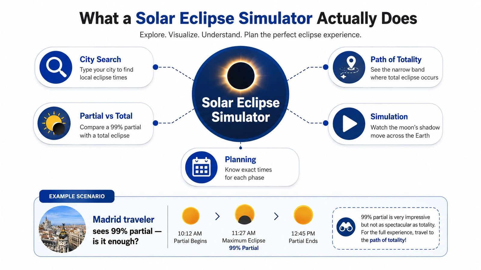
From a city name to a real forecast
A traveler in Madrid types the city into a simulator and sees a number like 99%. That number is useful, but it still leaves out the part that decides a trip. A good solar eclipse simulator turns orbital geometry into local timing, local coverage, and the question that matters in the field, am I inside the path of totality?
Eclipse prediction has deep roots. Babylonian and ancient Chinese astronomers were able to predict eclipses as early as 2500 BCE, and later scholars recognized a recurrence cycle of about 6,585 days for repeated eclipse geometry (historical overview). Modern simulators sit in that same line of work, except they can now calculate visibility from a city for hundreds of years into the past and future through NASA's eclipse tools, including the Javascript Solar Eclipse Explorer (NASA eclipse resources).
That is the practical difference between a simulator and a date on a calendar. A date tells you when the event exists. A simulator tells you whether you will see totality, a partial phase, or a near miss from your exact location.
Practical rule: if the simulator only gives you a date and not local circumstances, it is not enough for travel planning.
What you can trust and what you can't
The reliable output is geometric. You can trust the simulator for phase timing, local obscuration, and whether your location falls inside the narrow totality track. You should be more cautious when a tool skips over horizon obstruction, terrain, haze, or the fact that a sunset eclipse can be geometrically perfect and still disappear behind the wrong ridge.
A hilltop in Spain can look ideal on paper and fail in practice if the Sun drops behind a slope before the final phases finish. That is where planning tools often mislead users, because the geometry is correct while the horizon picture is not.
The 12 August 2026 eclipse is a good working example because Europe's experience is not uniform. Independent eclipse-map data identify Iceland and Spain as the European countries in the path of totality for that Wednesday (European path data). A simulator turns that map into a specific answer for your street, your hotel, or your ridge line, and the city list at the 2026 eclipse city list is where those local differences start to matter.
That is the value. A solar eclipse simulator does not just show the Moon covering the Sun. It tells you how to plan around that geometry without trusting a broad map more than the local horizon.
Reading the Interactive Map and City Simulator
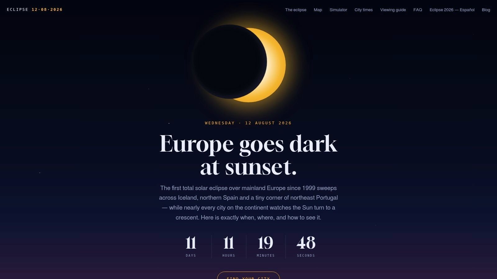
Start with the map, not the animation
Open an interactive eclipse map and zoom until the path of totality becomes a narrow corridor instead of a broad country outline. Then click the city you care about and read the local circumstances before you hit play. That order matters, because the animation is easier to interpret once you already know whether the place is inside the path or stuck in a partial zone.
On a city-by-city page such as the 2026 eclipse city list, the useful fields are the same ones you'd check in the field. Look for first contact, maximum eclipse, last contact, obscuration, and, if applicable, totality duration. If the tool shows a live shadow track, use it as a visual confirmation, not as the main planning answer.
A strong simulator also lets you scrub through time manually. That's more useful than watching a full animation, because you can stop at first contact, jump to maximum, and then check what happens near sunset without waiting for the whole sequence to play out.
Read the Moon's motion like a timing chart
The animated Moon should tell you three things at once. First, how quickly the coverage builds. Second, whether the site reaches totality or only a deep partial. Third, how much daylight remains when the eclipse peaks. Those are different questions, and field planning depends on all three.
If the simulator supports city-specific display, use it to compare nearby places instead of assuming a capital city is representative. Madrid, for example, may give you a very different practical result from a site farther north or west, even if both cities are in the same general travel zone. That's why city simulators matter more than continent-level maps.
If you're choosing between two sites, trust the one that gives exact local circumstances, not the one with the flashier animation.
The point is to extract clean data quickly. Once you know where maximum occurs, when the contacts happen, and whether totality is possible, you've got enough to make a real itinerary decision.
Interpreting City by City Timing and Coverage Data
How to read the table without overreading it
A city table is easy to misread if you treat every percentage as if it meant the same thing. It doesn't. The obscuration figure tells you how much of the Sun is covered at maximum, but it does not tell you whether you will get the corona, the darkness, or the full event. A city showing 99% can still be a partial eclipse, while a city at 100% is on a completely different level of experience.
Local time labels matter just as much. European simulators often use zone notation such as CEST, BST, WEST, and EEST, and those labels are there to keep you from mixing local timing with UT. If the simulator gives the eclipse in UT, convert it to local time before you book trains, hotels, or any photography setup that depends on being in place at the right minute.
A practical way to use the table is simple.
- Check the totality column first. If it says yes, you are in the narrow band that matters.
- Check the local maximum time next. If it is late enough that the Sun is low, horizon planning becomes critical.
- Read obscuration last. High obscuration is encouraging, but it is not a substitute for totality.
What the European table tells you
| City | Country | Maximum Eclipse | Obscuration | Totality |
|---|---|---|---|---|
| Reykjavík | Iceland | Local time shown in simulator | City-specific obscuration shown in simulator | Inside the path where marked |
| Madrid | Spain | Local time shown in simulator | City-specific obscuration shown in simulator | Outside or inside depending on the simulator's marker |
| Bilbao | Spain | Local time shown in simulator | City-specific obscuration shown in simulator | Inside the path where marked |
| London | United Kingdom | Local time shown in simulator | City-specific obscuration shown in simulator | Partial only |
| Paris | France | Local time shown in simulator | City-specific obscuration shown in simulator | Partial only |
| Berlin | Germany | Local time shown in simulator | City-specific obscuration shown in simulator | Partial only |
The table logic is what matters here, not the display style. Iceland and Spain are the European totality countries for 12 August 2026, so if your city sits outside those corridors, you are planning for a partial eclipse, not the main event (European path data).
That is the decision point. If your chosen city shows under 100%, look for a nearby location inside the path that you can reach. The simulator is giving you a travel decision, not just a reading.
Understanding the Phase Timeline and Low Sun Problem
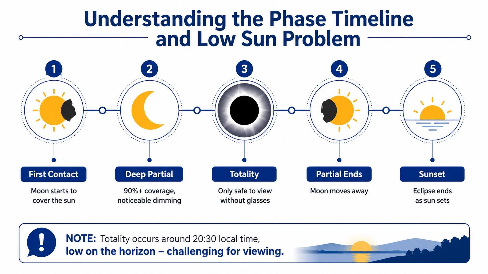
Read the eclipse as a sequence, not a single moment
A phase timeline is more useful than a single maximum-time stamp because it tells you how the experience unfolds. First contact starts the event. Deep partial is where the light starts looking strange. Totality is the short window that changes the day. Partial ends when the Moon moves away, and sunset can terminate the whole scene before the geometry is over.
For the Spanish track, the low Sun is the main complication. The point of greatest eclipse for 12 August 2026 occurs at 17:47:06 UT, with a central duration of 2m 18s, a path width of 293.2 km, and the Sun at 25.8° altitude at that point (simulator data). In northern Spain, the eclipse trends toward sunset viewing, which means the Sun can be much lower in the west than it would be in a midday eclipse.
That changes site selection completely. A perfect geometric alignment doesn't help if a hill, building, or haze layer blocks the western horizon at the critical minute.
Use altitude and topography together
The simulator gives you the timing. Then you need to check the angle of the Sun at your exact spot and compare it with a real horizon. That means terrain maps, ridge profiles, beach lines, and even city skylines matter. The best viewing site is often not the one with the highest obscuration, it's the one with an open western view.
The trouble is easy to miss on a screen. Some tools show obscuration or sky position and stop there, which can create a false sense of certainty. A sunset eclipse in Spain can be mathematically correct and visually disappointing at the same time if the local horizon is wrong (horizon warning).
Simple field rule: if you can't see the western horizon cleanly, don't treat the eclipse time as proof that you'll actually see totality.
Use the timeline to plan your arrival early enough to set up, scout the view, and move if the first horizon check looks bad. That's how the simulator becomes a field tool instead of a slideshow.
Why Totality Is Not Just a Bigger Partial
The experience changes at the threshold
A 99% partial eclipse may sound close to totality, but the useful part of the event is still missing. The last percent is where the corona appears, daylight drops sharply, and the sky stops acting like an ordinary afternoon sky. Those are not cosmetic differences. They are the event.
Experienced eclipse chasers focus on the path of totality for a practical reason. Partial phases are dim, interesting, and useful for checking gear. Totality is what people remember, and NASA's guidance says direct viewing is safe only during the brief total phase when the Sun's photosphere is completely covered, which is a clear reminder that the event changes character at 100% (NASA safety guidance).
A nearby city with deep partial coverage still leaves you outside that experience. If your simulator says 99.9%, you are still planning for a partial eclipse, not the full phenomenon.
Why the path matters more than convenience
A closer city outside the path is the easy choice, and it usually costs you the main event. The corona will not appear, totality will not happen, and the best part of the eclipse stays out of reach. That is the trade-off every traveler has to face.
For a practical planner, the choice is usually simple. Stay with a partial eclipse and accept it for what it is, or make the extra effort to get inside the path. If you are already traveling for Europe in August, the second option is usually the one that justifies the trip.
The publisher's path-focused tool, Umbra Solar Eclipse, fits this decision because it centers the difference between totality and the surrounding partial zone.
Do not let a near miss feel like a win. The simulator can show you that you are close, but eclipse chasing rewards the location that crosses the line.
That line is what makes the 2026 event worth planning around. The difference between 99% and 100% is not arithmetic, it is the difference between a partial sky and a total solar eclipse.
Safe Viewing and Photography Preparation
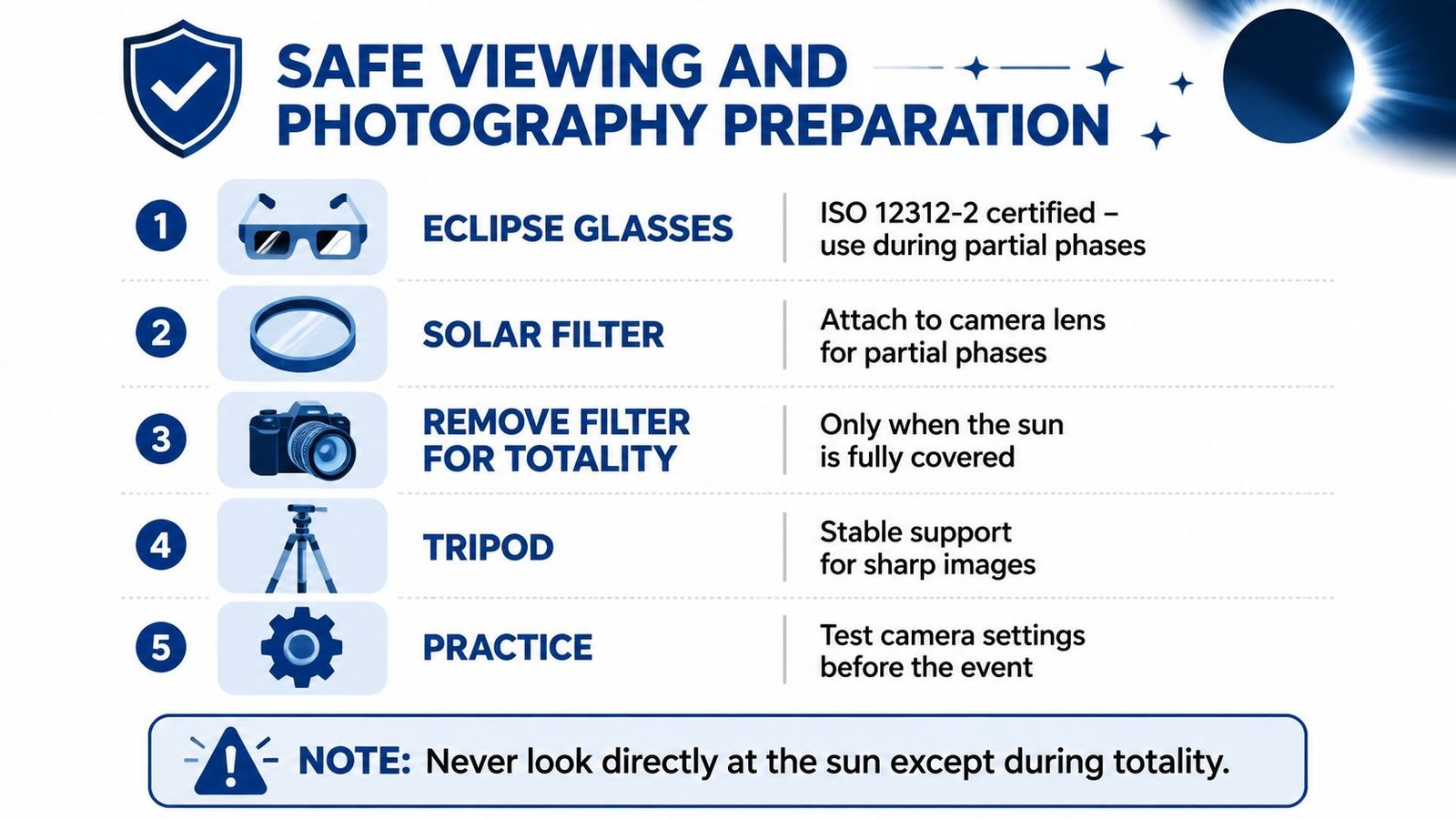
Protect your eyes during every partial phase
If you are outside totality, use ISO 12312-2 eclipse glasses for direct viewing. Direct viewing is only safe during the brief total phase, when the photosphere is fully covered. A 99% partial still needs eye protection.
A simulator is useful here because it tells you where the line is, but it does not change the safety rule. If the map puts you just outside the path of totality on Total Solar Eclipse 2026 Live path map, treat the event as partial from start to finish.
For camera work, keep a solar filter on the lens through the partial phases. Remove it only when totality begins, then put it back on as soon as the bright Sun returns. A tripod helps more than a fancy mount, because the low light at totality punishes shaky framing and rushed adjustments.
A clean pre-event checklist looks like this.
- Eclipse Glasses: Use ISO 12312-2 glasses whenever the Sun is not fully covered.
- Solar Filter: Keep a proper filter on your camera during partial phases.
- Remove Filter for Totality: Take it off only during the brief total phase.
- Tripod: Use stable support so you are not fighting motion blur.
- Practice: Test the sequence before eclipse day, not during it.
Set exposure plans before you leave
Photography gets harder when the Sun is low, because atmospheric extinction starts changing the brightness balance. For the eclipse from Spain, the Sun's altitude is a practical planning variable, not just an astronomical detail. If you are on the Spanish track near sunset, your exposure brackets need to account for a darker sky and a lower Sun than a midday eclipse would give you.
Simulator timing data is what lets you pre-program the camera. Use the local contact times to decide when to start monitoring, when to remove the filter, and how long totality is likely to last at your spot. That reduces the chance of fumbling a lens cap or missing the first seconds of the corona.
Test the whole sequence at home, with gloves if you expect cold air, and with the camera settings you will use in the field. A simulator cannot make the eclipse easy, but it can keep your hands from improvising under pressure.
Travel Logistics and Weather Strategy
Build the trip around weather, not just geometry
A perfect simulator result can still fail on the ground if the horizon is blocked. That matters most for low-sun events in northern Spain and western Iceland, where the path geometry can be right and the view can still fall apart because of hills, haze, or marine cloud. I plan trips around that gap between orbital accuracy and what you can see from a hilltop at sunset.
Holiday demand adds another layer. If you wait too long for accommodation, the eclipse corridor fills with people reading the same maps and timing tables you are. Lock lodging early, then leave room to adjust the final viewing site once the weather picture is clearer.
The cleanest workflow is simple.
- Pick the geometrically correct region first. Stay inside the path, and use the path of totality to narrow the search to places that can deliver the event.
- Compare cloud patterns next. Then choose between coast and inland based on the most realistic chance of a clear western horizon.
Coastal sites can look attractive on paper, but inland Spain often wins in practice. A site that is slightly less scenic but has a clearer sky and an open sunset line is usually the better field choice. When the eclipse is close to the horizon, visibility beats postcard appeal.
A mobile plan beats a fixed one almost every time. Rent a car if you can, map two or three backup sites on different roads, and keep an eye on satellite imagery in the final hours before contact. If a cloud deck settles on the western horizon, being able to move inland can save the session.
Answer the questions that usually come last
Simulator timings are usually given in UT, so local planning still needs a time-zone check before you leave for the site. Add your offset before you schedule departures, meals, and setup. That keeps you from arriving too early, or missing the useful window because you trusted the wrong clock.
A city showing 99.9% coverage is still a partial eclipse. If totality is reachable within your travel limits, move for totality, because the geometry says the experience is different in kind, not just degree.
Clouds are the split between geometry and reality. Simulator output remains reliable for where the eclipse occurs, but it cannot tell you whether the sky will cooperate when the Sun is low and the horizon is fragile.
The features that matter are timing, coverage, and altitude data. Flashy 3D animation looks good on screen, but it does not help you decide where to stand, when to move, or how long the Sun stays in range. A planning tool that shows exact local circumstances is useful. One that only looks polished is not.
A focused planning site still has value because it keeps the practical pieces in one place. Total Solar Eclipse 2026 Live brings together city timing, path details, safety guidance, and Europe-specific planning notes, which makes it easier to turn simulator output into an itinerary. If you are choosing between Madrid, Bilbao, Reykjavík, or an inland backup, check the timing and path data there before you commit to the last leg.